
As everyone knows, I am still trying to catch up on our blog. I think I'm getting close and then I find myself behind again. I am writing this on September 28th and I'm trying hard to remember what we did almost a month ago. I want to get to the point where I write something every day -- hopefully, soon, I will get there.
After leaving South Dakota, our first stop was at the Checkers Campground in Welcome, Minnesota. Checkers is a Passport America park -- can't beat $12 for full hookups with 50 amp service. However, the little man that escorted us to our site informed us if we planned on doing laundry it would be a dollar more -- "city water, you know." There's nothing special about this campground, but it was okay for a one-night stop.
After leaving South Dakota, our first stop was at the Checkers Campground in Welcome, Minnesota. Checkers is a Passport America park -- can't beat $12 for full hookups with 50 amp service. However, the little man that escorted us to our site informed us if we planned on doing laundry it would be a dollar more -- "city water, you know." There's nothing special about this campground, but it was okay for a one-night stop.

We were up and on our way the next morning. We stopped at a rest area just inside the Wisconsin line.

We picked up a listing of Wisconsin campgrounds and Alan selected one and we were off to find it. Unfortunately, I do not have anything to even remind us of the name -- as you see, after we drove several miles off I-90 and finally arrived at the campground, we immediately knew we would not be staying. When the first thing we saw was a beer advertisement on the front of the office, we knew this was not the place for us -- not to mention we would have to climb a hill to a parking site and there were folks swimming in what looked like a dirty pond. We promptly turned around and headed back down the road, telling ourselves if it's not right off the highway, we aren't stopping!!
However, we again chose one that was approximately ten miles off I-90 -- Leon Valley Campground in Sparta, Wisconsin, but it had decent reviews on www.rvparkreviews.com.


However, we again chose one that was approximately ten miles off I-90 -- Leon Valley Campground in Sparta, Wisconsin, but it had decent reviews on www.rvparkreviews.com.


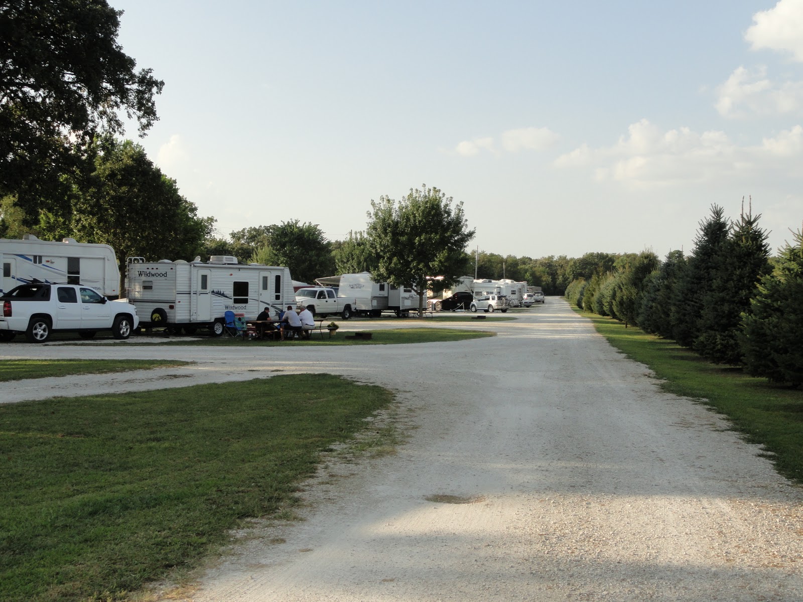
Leon Valley had a LOT of residents and seasonals and they charged way too much -- $36 and no sewer. We should know better by now. And rules -- did they have the rules.


 We thought this one was the best of all -- did you notice the sign "Garbage Dumpster" with an arrow pointing to the left...then the big sign under it "NO REFUSE CONTAINERS...TAKE GARBAGE WITH YOU." What a classic -- don't think we have been anywhere, where they told us to take our garbage with us...lol. We know there's a reason for every rule, but expecting everyone to take their garbage with them was just too much.


Our initial plan was to stay at Hickory Hollow four nights but we ended up staying nine days total. Even though it was Labor Day weekend, they gave us the Passport America rate for two more days. It ended up costing us $26 a night with both Passport America and Good Sam discounts.
We did a little shopping at the local mall and I got my hair cut. We even visited the Starved Rock State Park, a short distance from the campground.


We made it through the night with no problems and we were up and determined to make it to Utica, llinois. We had reservations at the Hickory Hollow Campground. Hickory Hollow is a Good Sam and a Passport America park. The limit on Passport America is two nights in a given week. It is a very nice campground and very big. The literature says it has 85 total RV sites, but it also has a number of tent sites. The owners were very friendly and helpful.


More cornfields


Our initial plan was to stay at Hickory Hollow four nights but we ended up staying nine days total. Even though it was Labor Day weekend, they gave us the Passport America rate for two more days. It ended up costing us $26 a night with both Passport America and Good Sam discounts.
We did a little shopping at the local mall and I got my hair cut. We even visited the Starved Rock State Park, a short distance from the campground.


The Illinois River is adjacent to the park.


We visited the Information Center where we learned about this elm tree.

This was one of the largest American elms in Illinois. It was destroyed by the elm bark beetle. It was 85 feet tall with a diameter of over 5 feet and supported the largest known crown in the country of 126 feet. We also learned about the early Illinois explorers and the Indians that once roamed this area.


Native Americans settled in great numbers near the fort to gain protection from the feared Iroquois tribe and to be near a source of French trade goods. Fort Louis was used as a refuge by traders and trappers until fire destroyed it, approximately in 1720. In the decades that followed, the French halted plans of colonization and left the area in 1765.
Starved Rock State Park derives its name from a Native American legend of injustice and retribution. In the 1760s, Pontiac -- chief of the Ottawa tribe -- was slain by an Illiniwek. According to legend, during one of the battles that occurred to avenge his killing, a band of Illiniwek, under attack, sought refuge atop a 125-foot sandstone butte. The Ottawa and Potawatomi surrounded the bluff and held their ground until the Illiniwek died of starvation -- thus the name of "Starved Rock."
We decided to find our way to "the" Starved Rock. We could see it in the distance -- so we thought -- can you see it to?


There must be at least a 100 steps down

Here we go...don't forget we've got to come back up.

Okay, we're down...what -- we've got to up -- again -- OH ME!!


We made it to the top and this is what we saw overlooking the Illinois River:


Plum Island where bald eagles can be seen in the Fall.

We did make it down and back up. We planned to seek out a waterfall we were told about, but after we got to the canyon and started the trail, we both realized there was no way we could walk...my leg started hurting very badly, so we went back to the campground to rest.

We're pretty sure I re-injured my leg with all that walking and climbing...it's been swollen and painful a lot since then -- thank goodness for Ibuprofen. When we return to North Carolina, we want to see if we can be seen at the Duke Orthopedic Clinic -- both of us...Alan for his foot and me for my leg.
We watched everyone pack up and leave the park on Labor Day. Then we left Utica ourselves the following Tuesday for Elkhart, Indiana, a few short miles from Goshen and the Escapade. Be sure and come back to see what we found there. In the meantime, may God continue to bless our voyage, as well as our family and friends everywhere.


